



Skip to content
View in the app

A better way to browse. Learn more.

DonsTalk

A full-screen app on your home screen with push notifications, badges and more.

To install this app on iOS and iPadOS
  1. Tap the Share icon in Safari
  2. Scroll the menu and tap Add to Home Screen.
  3. Tap Add in the top-right corner.
To install this app on Android
  1. Tap the 3-dot menu (⋮) in the top-right corner of the browser.
  2. Tap Add to Home screen or Install app.
  3. Confirm by tapping Install.

The Hills and Outdoors thread

A wee thread for your outdoor pursuits.routes up local and further afield hills and mountains, low level walks,mountain bike trails,wild camping,ski reports.Anything else outdoorsy that others may want to mention/recommend.


  My thing is hill walking mainly,with a bit of skiing now and again.Ill start things off with a few routes of hills of varying difficulty, starting with the toughest,from the South Cairngorms


1)      Bheinn A Ghlo,Carn A Chlamain,Beinn Dearg,Carn an Fhidlier,An Sgarsoch


The approach route i took for these hills can also be done as a low level walk,or mountain bike route without doing the hills. Starts at the Linn of Dee,5 miles beyond Braemar,and carries on through to Blair Atholl at the far end.Takes you through some of the furthest from civilisation landscape in the UK.


My plan was to bike and walk in on an evening, to just beyond the Falls of Tarf (at the side of the river Tilt),set up camp and do the west side Munroes the next day,and then Beinn A Ghlo's 3 munroes on day 2, and then back out


Parked at the Linn of Dee,and followed a good low level track to white bridge,where it splits in 2.Took the route South over the bridge,and past Bynack lodge,all the way to the falls of Tarf.

  I should point out that,cycling absolutely kills me. I never normally cycle anywhere, except a couple times a year to get to some hills.Any gradient at all and I need to come off and push.This route was pretty reasonable all the way to around Loch Tilt


Track near Bynack to give an idea of terrain.Easy biking /walking,great sense of space around here


IMG_2240_zpshyibjhhu.jpg


Track near the Falls of Tarf.Pushed the bike at this stage,though a regular M/biker would breeze it.Easy enough walking.


IMG_2250_zpsqequ0hl7.jpg


I set up camp at the start of a track at,OS - 972,775 (Braemar/Blair Atholl map),took about 2 hrs to reach here,appx 2/3 bike,1/3 hike.

  In the morning,followed the track that heads towards a sheiling/old building on the edge of the Tarf water,and headed up An Sgarsoch first(initially a bit rough),then over to nearby Carn an Fhidlhier.From there over to Beinn Dearg,round by the west side of Loch Mairc,and up Carn A Chlamain,before heading for the track on Braigh choire na Conlaich back to the tent.

  A long summer day needed


Day 2 was the Beinn A Ghlo route, starting from the tent,down Glen Tilt to the bridge at Marble Lodge.From there,make way up Carn Liath,the first Munro,along to Braigh Coire Chruinn bhalgain,the second,and then to Carn nan Gabhar.From there head down to Meall A Mhuirich, looking out for a stalkers path to help you down to Glen Tilt and aiming for the bridge across the Tilt river,around 3km above Forest lodge


  .An Sgorsach and Carn an Fhidhlier can be done seperately by following the same route initially,but turning up the track at the Geldie burn,past Geldie Lodge,where a path leads you on to Carn an Fhidhlier,over to An Agarsoch,and back to the Geldie Burn/Linn of Dee.

  If not doing An Sgarsoch/Carn an Fhidhlier,the other hills are best planned from the Bridge of Atholl side.

Glen Tilt,a very attractive glen


2)  Geallaig hill - 743m


An easier hill,just past Ballater on the road to Braemar.The tourist route for this one is a rather drab track from the north side,but can be done from the South via this route.

  Park at the first car park on the right,just after the Coilecreich Inn.walk west along the road until you come out from the trees.There is a wooden gate on your right hand side.Go over that,and follow the grassy track up hill,which becomes more of a vehicle track further up.About two thirds of the way up the track seems to veer away from the summit,but a path appears,and takes you on to the top.

  Good views of Lochnagar and Upper Deeside. 1 or 2 hrs up and the same down depending on fitness


3) Millstone hill - 408m


  And a good starter hill on the south side of Bennachie.Parked at the Donview visitor centre near Blairdaff with good paths all the way.Took about an hour up,hour doon with a couple of 7 year olds.Theres also a link path from the summit over to the South top of Bennachie.


  Nice Aberdeenshire landscapes en route,and some nice spots along the river Don nearby,...which is nice


EDIT - A link to a map which you can zoom in for more detail.Sometimes shows paths not seen on an OS map


http://www.hill-bagging.co.uk/search.php?ct=SEWM


  • Replies 301
  • Views 113k
  • Created
  • Last Reply

Top Posters In This Topic

Most Popular Posts

  • Biggest island of the small isles,but only about 40 inhabitants who mostly live in Kinloch the harbour village.The rest of the island probably too rough or exposed id say.Fantastic mountains.Not huge,

  • Nothing to add to the fitba thread.Done a few more sections of the coastal route.Newtonhill to Muchalls was a bit dour.Muchalls to Stoney was brilliant.Lots of twists,turns and surprises on the way.

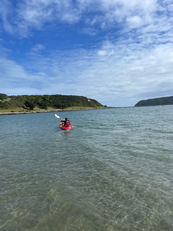
  • Finally made it out on the mountain bike after probably nearly a year and a bit. All the stars aligned which meant I could make it to Makara which is west of Wellington. Good gruelling 1hr long ride u
Posted Images

Featured Replies

I watched a few clips on YouTube of climbers walking An Teallach and thought that Aonach Eagach looked more technical. But that was me sitting on a computer in the air con thinking that. A bit different being up there. 

  • Author

Havent done An Teallach,or Liathach but did Aonach Eagach just over a year ago.It was a fantastic day out,but if the weather hadnt been perfect and I was on my own I doubt I would have had the balls to complete.There were a couple of down climbs that I needed my fellow walker to guide my feet.

   what Ive gathered about AT and Liathach is you can make it as difficult as you want by going over all the tops,but that there are bypass routes if you dont fancy them,though some of the bypasses are said to be almost as dodgy as going over the tops.

   Only 60 left to do,but nae sure I'll actually complete.

Pic is of the Chancellor on Aonach Eagach

51023171611_35655ea50b_c.jpgIMG_8018 (1) by , on Flickr

6 hours ago, Elgindon said:

Havent done An Teallach,or Liathach but did Aonach Eagach just over a year ago.It was a fantastic day out,but if the weather hadnt been perfect and I was on my own I doubt I would have had the balls to complete.There were a couple of down climbs that I needed my fellow walker to guide my feet.

   what Ive gathered about AT and Liathach is you can make it as difficult as you want by going over all the tops,but that there are bypass routes if you dont fancy them,though some of the bypasses are said to be almost as dodgy as going over the tops.

   Only 60 left to do,but nae sure I'll actually complete.

Pic is of the Chancellor on Aonach Eagach

51023171611_35655ea50b_c.jpgIMG_8018 (1) by , on Flickr

Have you done any of the Munros on Skye, ED? I think if any of the munros were going to beat me it would be Sgurr Dearg.

Shits me off when I see Danny Macaskill doing it on a bike...


Having only 60 or so Munros to do is amazing. I'm very jealous. I'm no sure what age you are, but fingers crossed that you get the rest of them done! 


  • Author

Only got Sgurrs Dearg,Alasdair,Mhic Chonnich and Dubh Mor to do,not sure i'll ever manage the In Pinn though,even with a guide.

 Did you get many Munros done before you left?

2 hours ago, Elgindon said:

Only got Sgurrs Dearg,Alasdair,Mhic Chonnich and Dubh Mor to do,not sure i'll ever manage the In Pinn though,even with a guide.

 Did you get many Munros done before you left?

I moved to Oz when I was 22 so I never got that many done. I think I did about 17. Getting up the mountains is something I really miss. It always felt like I had a clearer head after being on the hills.

  • 2 months later...
  • Author

Discovered Glen Dye only recently,nae sure why we havent wandered about here before.From the Clattering Brig alone theres a myriad of tracks and paths of different terrain to walk and/or cycle.Same as you head along to Bridge of Dye

 Back on the Munros recently.A sweaty clamber up rocky Sgurr na h-Ulaid,via the RHS in photo

51191919631_1125783f1b_c.jpgDSC04115 (2) by , on Flickr

Sgurr A Mhaoraich,Loch Quoich - Easy walking,one of the best summit views anywhere

51192995985_57fbdb0094_c.jpgDSC03923 by , on Flickr

And first camp for over a year 

51192720019_5335ca3a33_c.jpg20210501_064836 by , on Flickr

Edited by Elgindon

  • Author
3 hours ago, scotfree said:

Is the peaked mountain in the tent photo Gleouraich?

No,the base of Gleouriach(fantastic viewpoint) is practically 20m right of the photo.The hill in the photo is looking West to Sgurr na Ciche and Knoydart

1 hour ago, Elgindon said:

No,the base of Gleouriach(fantastic viewpoint) is practically 20m right of the photo.The hill in the photo is looking West to Sgurr na Ciche and Knoydart

Ooooft! I was well off!

confused GIF by Call of Duty World League

  • Author

If you havent done Gleuoriach and Spidean Mialach, definitely worth it if over again. Fairly easy Munro wise.Great views out to Knoydart/Skye ?

Had a works trip down to the South Island on the weekend. A rare weekend with the kids for me (my wife assured me it’s on the ever growing list). Managed a couple of mountain bike rides and had a stunner weather wise. Was staying out near hanmer springs (for some reason it’s spelt that way rather than hamner but hey Ho) and rewarded myself with the hot springs afterwards ?


2198FCF9-AA3E-46B6-8A7F-D3630787256A.jpeg

55AB85FB-1118-45A0-9F82-21CF135B7F14.jpeg

9D227596-9B22-49DB-8A28-E0B9C13A4734.jpeg

Least you don't have any snakes over there, Manc. There are some lovely trails over here, but snakes give me the fear and I've had a few run in's in the past...

snake bite GIF

  • 3 months later...

First time up Ben Nevis yesterday. 
Glorious weather, if anything it was too hot as it was hard work. I’ve run 2 marathons, couple of dozen half marathons and 7 other Munro’s but that was easily the toughest thing I’ve ever done. I was expecting it to be a slog but hadn’t realised how difficult under foot it is, it’s almost non-stop stones and boulders all the way - it was very tough, but the views were spectacular. 
 

It was like Piccadilly Circus at the top! A good 200-300 folk up there and easily more than 1000 on the path yesterday. 
A8C24E97-F27F-40FC-8A04-1F600E96E8FE.thumb.jpeg.d70d12470846eddaa6eaf81ca1d8f6a6.jpeg493BB7A9-8C4C-4C35-B82C-5705D5A5B8A7.thumb.jpeg.7424e683d3ba207744dcc8f27f5f88f8.jpegA2CA9E95-5663-4CF8-8368-E68EF4DE7912.thumb.jpeg.1b3c463b6a4f732421cb1942e284f2c5.jpeg703530AA-A266-44FE-93DB-2502857EB75A.thumb.jpeg.9a3c1e5923df3d809408a4c8192c6770.jpeg

  • Author

Nice pics.Aye, I wasn't bothered about doing Ben Nevis but when I got round to it,was surprised how good the views were. 

Was up Glencoe yesterday,as you say,way too warm ,little wind. Pics later ?

Way back in the 1988, me and a mate walked along the bottom of the North face of Ben Nevis. We heard a helicopter flying around and out the clouds came a big yellow Sea King helicopter. It landed near us and all of a sudden a mountain rescue guy and two other guys, one with a tv camera and the other with a sound boom ran up to me and my mate. The mountain rescue asked us If we had seen two guys in some problems around the North Tower. We had not. The three guys ran back to the helicopter and flew off. We only found out later that It was for a documentary series called Rescue. It was a bit of a surreal moment...

https://en.wikipedia.org/wiki/Rescue_(British_TV_series)


The photo with the Ballachulish bridge in it. 😍

  • Author
12 hours ago, scotfree said:

The photo with the Ballachulish bridge in it. 😍

That was on the way down from the Pap of Glencoe.Similar height to Bennachie with great views. Worth a trip if you get back over.Paths a bit stony/uncomfortable but easy otherwise

https://www.walkhighlands.co.uk/grahams/pap-of-glencoe


  • 2 months later...
  • Author

Latest trips report.Just finished the last section of the Speyside way from Spey Bay to Aviemore.While the walking was decent enough,we were a wee bit disappointed by the amount of time next to the Spey.Good walking paths,mostly cyclable too. 6/10  https://www.speysideway.org/route-sections-online-guide/

Typical path near Nethy Bridge 

DSC05265.jpg

We were at Crathes castle grounds yesterday,parked just as you turn off the main road,under the bridge.Lots of  path routes to take,decent walking,more paths at the top side of the castle.Go Ape adventure playground,and cafe.If youre into your castles(we're not) theres the castle and gardens to look round. 7/10. https://www.nts.org.uk/visit/places/crathes-castle?gclid=Cj0KCQjwrJOMBhCZARIsAGEd4VEILqLs7078Ny2ufJLSgl3_5TURUxXCa0EqJZZFZycqbPGKVxKobT0aArAaEALw_wcB&gclsrc=aw.ds

  rickety bridge on the yellow route

DSC05304.jpg


Edited by Elgindon

It was a wee while back now, but me and the wife walked up to Finch Hatton gorge. We had just went for a wee drive and ended up walking the path to the gorge. The wife is born and bred here in Mackay, but it was not a place she had been to yet.

005.thumb.JPG.459332cefc992548ecf64e9ff5dd1192.JPG

025.JPG

028.jpg

037.jpg

039.jpg

058.jpg

064.jpg

073.jpg

091.jpg

  • Author

Looks lush, equatorial which you almost are

On 06/11/2021 at 20:05, Elgindon said:

Looks lush, equatorial which you almost are

It was actually during a dry spell. The waterfall is usually got more water coming down it. There are two waterfalls up there. The one I walked to was the smaller one. The big one is called The ring of fire. Every year you get someone killed up there. Mainly tourists.   

The Ring of Fire.

7-min-2.thumb.jpg.812c41b0bce42be25032ae0526fb5937.jpg


This photo was taken on the same day we went to the gorge. Not long after, we had some nasty bush fires come through.


098.thumb.jpg.41d7b8abe8fbe6ab46a44bba18735f3c.jpg


This was the sky from my place when the fires where going through the Pioneer Valley.  

066.thumb.jpg.89c0f25589f34e9f484820def8a3dfcc.jpg

8 hours ago, scotfree said:

The one I walked to was the smaller one. The big one is called The ring of fire. Every year you get someone killed up there. Mainly tourists.

Why is that then? It looks fairly harmless in the photo. Are they drowning, falling? Or is it just your standard Australian tourist-murder like you see in the films?

On 08/11/2021 at 18:11, RicoS321 said:

Why is that then? It looks fairly harmless in the photo. Are they drowning, falling? Or is it just your standard Australian tourist-murder like you see in the films?

The rocks are slippery as fuck. Also, at the bottom of the waterfall is many a submerged rock that has caused deaths/injuries. Alcohol is a one way trip to the hospital (or worse).  I was a bit over the top when I said someone dies every years there, but there have been deaths every few years and many a time (at least once a year) that they have to get the rescue team up there. 

  • 1 month later...
  • Author

Fine day at Forvie am,Hill of Fare pm via Raemoir http://www.walkscotland.com/walk153.htm

DSC05636-2.jpg


DSC05640-2.jpg

Edited by Elgindon

Join the conversation

You can post now and register later. If you have an account, sign in now to post with your account.

Guest
Reply to this topic...

Important Information

Terms of Use

Account

Navigation

Search

Search

Configure browser push notifications

Chrome (Android)
  1. Tap the lock icon next to the address bar.
  2. Tap Permissions → Notifications.
  3. Adjust your preference.
Chrome (Desktop)
  1. Click the padlock icon in the address bar.
  2. Select Site settings.
  3. Find Notifications and adjust your preference.